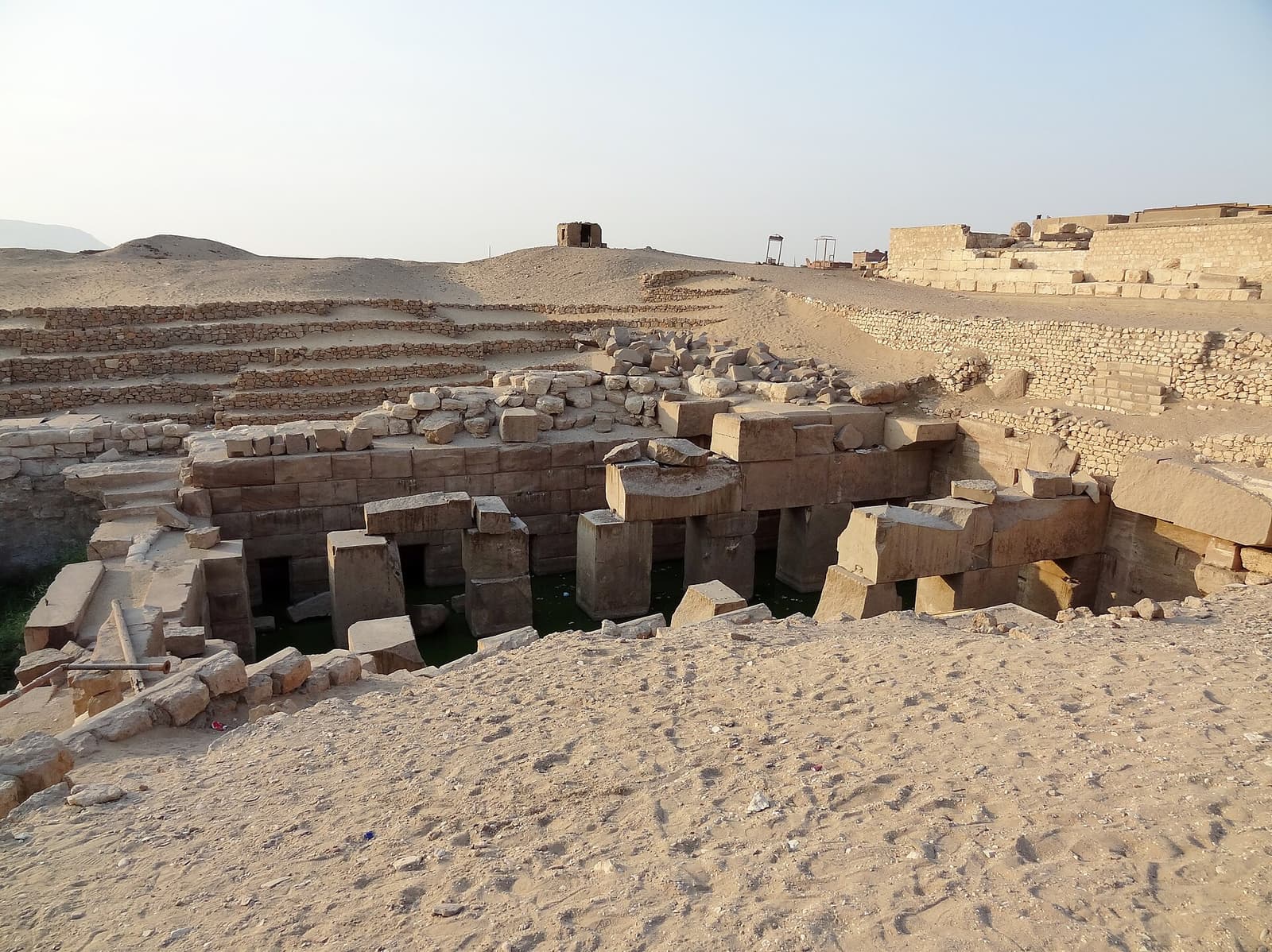
Osireion of Abydos
A massive granite structure buried 13 meters under the sand, flooded by the water table for centuries. Built by Seti I as a cenotaph of Osiris — the theory of an older site, advanced by Naville in 1914, has since been refuted but is still sometimes cited.
- Location
- Egypt · Africa
- Civilisation
- New Kingdom, 19th Dynasty (Seti I)
- Period
- ~−1279 → ~−1203 BC
- Technique
- Aswan granite and red sandstone, monolithic pillars, enclosure buried ~13 m below ground
- Studies
- EES excavations 1902–1930; hydrological monitoring since 2023
real support, not settled. A revisable snapshot of the state of research, never a judgement.
→ Show on the mapThe elements of the site
Where the site is
26.184° N, 31.918° E · satellite view
What science says
Attribution to Seti I (19th Dynasty, r. ~1294–1279 BC) solidly established by royal cartouches on bricks and granite clamps, and by the reliefs of the sarcophagus chamber. The monument's axis fits into the overall plan of Seti I's temple complex, a unified design. The 69 m access tunnel was completed under his successor, Merneptah.
Technique: monolithic pillars in pink Aswan granite (formerly called 'syenite'), about 2.1 × 2.1 m in cross-section and 4.2 m high. Outer enclosure walls in red sandstone, ~6 m thick. The entire structure lies buried ~13 m below the contemporary ground level.
The water table permanently feeds the central pool — no lasting dewatering has ever been achieved. Since December 2023, a team (Westerman / University of Sohag) has deployed continuous CTD sensors to characterize the sources. A geophysical and isotopic study (Abudeif et al., Minerals, 2023, DOI 10.3390/min13010064) identifies three mixed sources: ancient Nile waters, post-Aswan-Dam waters, and deep paleo-waters.
Abydos (including the Osireion) has been on the UNESCO Tentative List since 2003 (criteria iv and vi, Sohag Governorate), nomination status ongoing. The World Monuments Fund selected the site for its Watch program in 2022, in partnership with the American Research Center in Egypt.
Frankfort's stratigraphic excavation (EES, 1925–1930; publication EES Memoir 39, 1933) established that the building belongs to the reign of Seti I, refuting the Old Kingdom thesis through analysis of the layers and tool marks.
What remains unexplained
Related to
Studies & sources
Keep exploring
 Debated
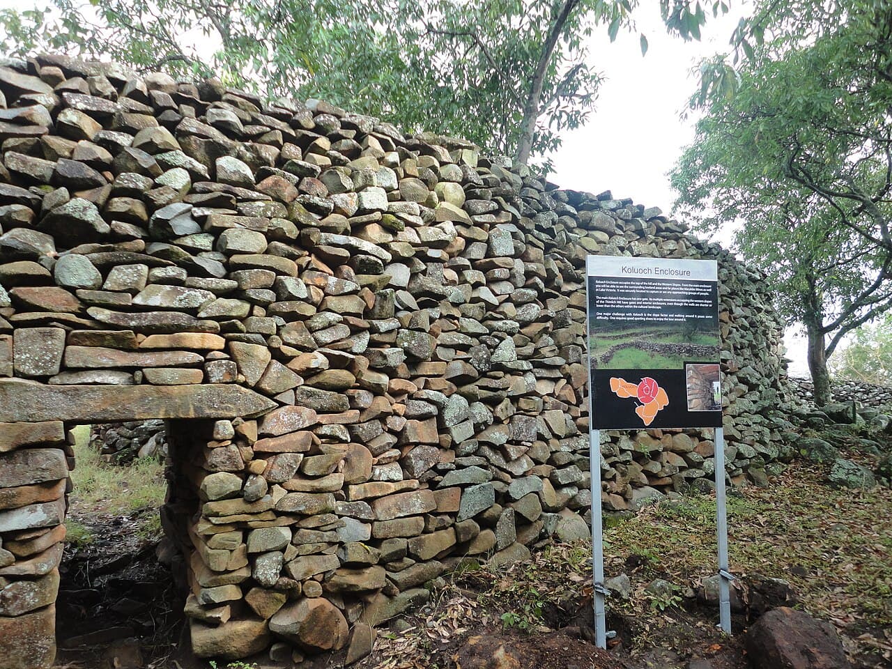
Thimlich Ohinga
Double-faced dry-stone enclosures, without mortar, near Lake Victoria. Built between the 15th and 16th centuries by Bantu communities and later the Luo. Who started them, who continued them?
 Consensus
Churches of Lalibela — Biete Ghiorgis
Eleven churches carved from a single block of rock, with no masonry added. At Lalibela, construction does not add up — it subtracts. Biete Ghiorgis, the most perfect, descends into a trench 25 m to a side: a three-dimensional Greek cross cut into the tuff, with its gutters, its light shafts and its drainage channels, still in use 800 years later.
 Debated
Stelae of Tiya
Thirty-six stelae carved with swords, planted on warriors' graves in the Ethiopian highlands. Dated between the 10th and 15th centuries — but no one knows who erected them, or what their symbols mean.